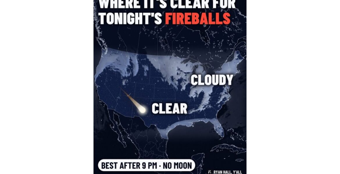
OKLAHOMA — Tonight’s meteor shower may be a small one, but it is famous for something special: big, slow fireballs. The Taurid meteor shower is active on Wednesday night November 11, and viewing is best after 9:00 PM with no moon in the sky. Our cloud forecast shows the Southwest, Oklahoma, most of Texas and
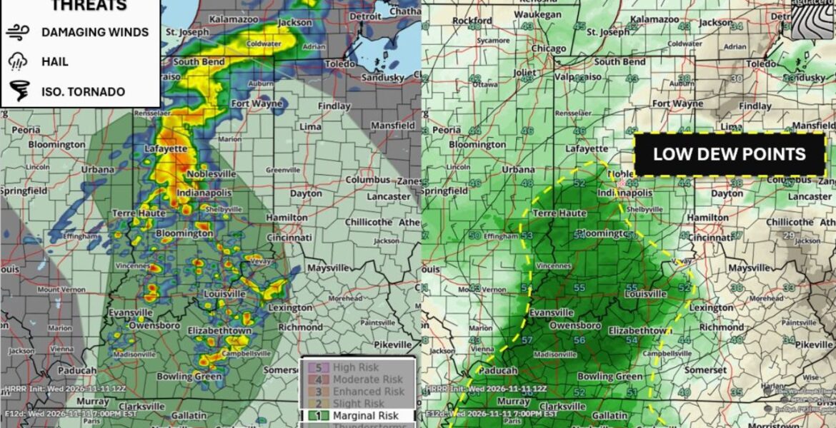
BLOOMINGTON, Indiana — A few strong to severe thunderstorms are expected to fire up across parts of eastern Illinois, Indiana, Kentucky and Tennessee on Wednesday November 11. The area sits under a Marginal Risk, Level 1 of 5, with storms possible after 4:00 to 5:00 PM ET. There is one big factor working against stronger
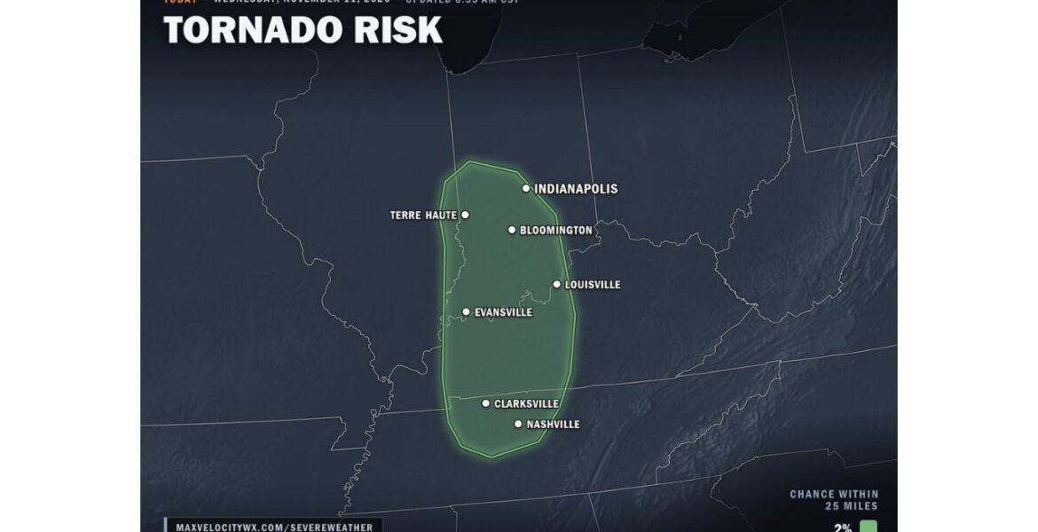
LOUISVILLE, Kentucky — A brief tornado cannot be ruled out on Wednesday afternoon and evening November 11 across Indiana, Kentucky and Middle Tennessee. Our tornado risk map, updated at 6:55 AM CST, outlines a zone that includes the Indianapolis, Louisville and Nashville areas. The chance is low, at 2% within 25 miles of any point
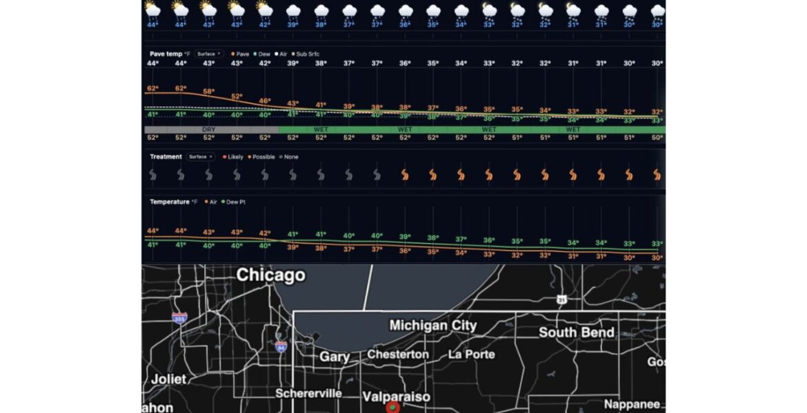
VALPARAISO, Indiana — Colder air sweeping across Lake Michigan is set to bring lake effect rain and snow showers to northwest Indiana from Thursday November 12 into Friday November 13. Temperatures around Valparaiso will slide from the mid-40s on Thursday afternoon into the lower 30s overnight. By Friday morning, road surfaces are expected to cool
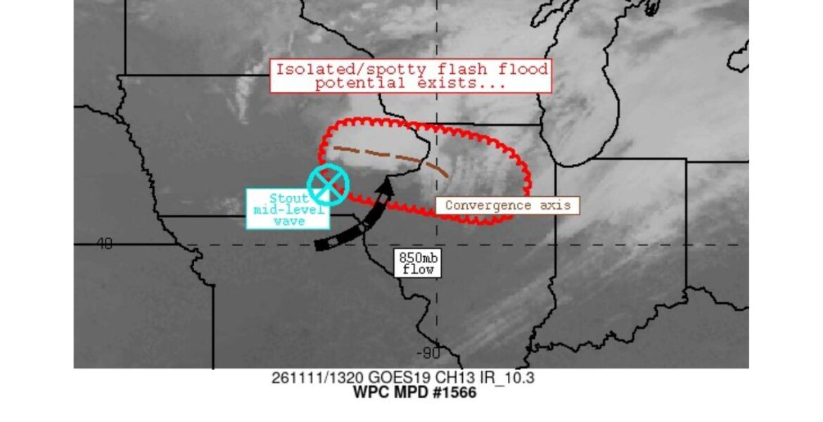
EASTERN IOWA — Heavy rain across the Midwest on Wednesday morning November 11 brought a risk of isolated flash flooding from eastern Iowa into northern and central Illinois. Our team flagged the threat at 7:20 AM CST as rain began lining up along a narrow band stretching east across the Mississippi River. The flooding risk
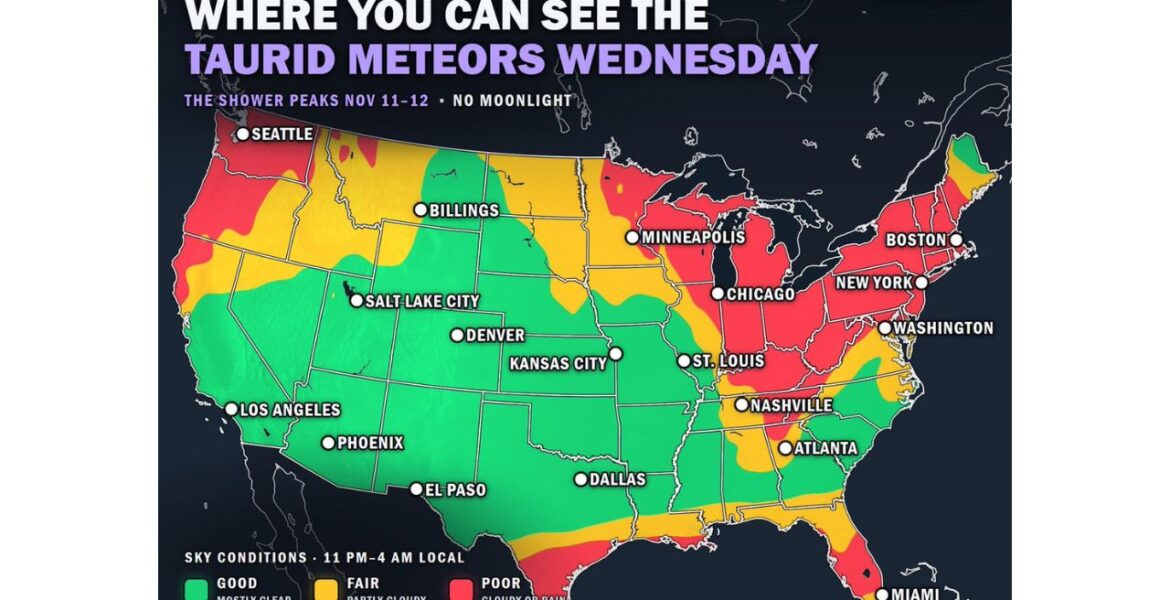
DENVER, Colorado — The Northern Taurid meteor shower peaks from Wednesday night November 11 into Thursday morning November 12, and there will be no moonlight to get in the way. While this is a slow shower, with about 5 meteors an hour from a dark spot, it is known for producing the occasional bright fireball.
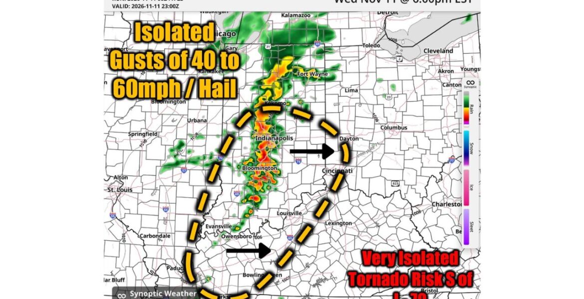
INDIANAPOLIS, Indiana — Storms are expected to roll across Indiana, Kentucky and Ohio on Wednesday evening November 11. Our team is watching for isolated wind gusts of 40 to 60 mph and hail, with the main window running from 4:00 PM to 9:00 PM ET. A very isolated tornado cannot be ruled out south of
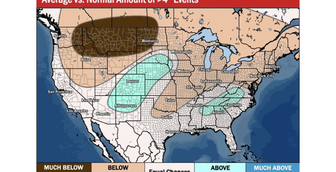
DENVER, Colorado — A new winter outlook is giving an early look at where major snowstorms could be more or less common this season. The outlook compares the expected number of snow events of 4 inches or more from November through March to what is normal. Denver, Albuquerque and Atlanta sit in areas that could